

The first phase of the Five Borough Bikeway could be implemented quickly through temporary measures like paint and bollards, and ultimately, permanently over time with investments from recovery dollars to produce a new, resilient form of infrastructure.
Once implemented, the priority lanes of the Five Borough Bikeway will be there to support New Yorkers through the remaining phases of this pandemic: through current physical distancing practices; through the time that follows as New Yorkers transition to using transit again; and through any subsequent spikes in cases that could require physical distancing again.
Beyond the pandemic, the Five Borough Bikeway will also be a cornerstone of a broader strategy to reduce greenhouse gas emissions, create more affordable and healthy ways of getting around, and allow us to prepare for climate change-induced disasters. It is imperative that we invest in this vision.
The report that follows establishes the importance of safe and effective cycling in NYC, builds support for a new priority level of bike lanes, and advances recommendations for how to achieve them. It provides a blueprint for how to implement protected, high-capacity bicycle lanes at a faster pace, and with fewer delays.
This vision has become all the more critical in the midst of the global pandemic that has hit NYC particularly hard. NYC needs creative ways to bounce back and to invest in a greener future.

- Create the Five Borough Bikeway, a 425-mile network of protected, continuous, high-capacity, priority bike lanes that allows for timely, safe, and predictable bike travel for a variety of types of bike journeys. It would serve as the central spine of the complete network of protected lanes envisioned by NYC.
- Benefits of the Bikeway include: an increase in bike ridership; reduction in intermodal conflict between bikes, cars, and pedestrians; reduction in air pollution while shrinking NYC’s carbon footprint; reduction in traffic congestion due to cars; and accommodations for new modes of transportation and micro-mobility.
- Start implementing temporary parts of the Bikeway as part of the COVID-19 recovery, and in the longer term, create a task force to develop a broader city-wide vision for a connected, high-capacity Bikeway. The task force should focus on streamlining the public outreach and construction process and attracting new cyclists of all ages, genders, races, and incomes.
- Develop and start to build bicycle capital projects that will be implemented as part of a broader public works agenda and have a game changing effect on cycling rates in NYC.
For nearly two decades, NYC has been building out bicycle infrastructure as part of a broader effort to become a more sustainable and equitable city. Because of the unwavering dedication of bike and pedestrian advocates over decades, NYC has stepped up and added hundreds of miles of bicycle lanes, adopted a Vision Zero policy, put the Citi Bike bike share program on city streets, and successfully driven down traffic fatalities. Although there is safety in numbers, with increased ridership comes a greater number of conflicts for cyclists in the streets, where there are a limited number of physically protected lanes.
Many of NYC’s cycling advancements up to this point have been through the use of quick, painted on bike lanes implemented by New York City Department of Transportation (NYC DOT). But given the increasing demand for our streets, from cycling and micro-mobility devices like e-scooters, to the growing number of for-hire vehicles and delivery trucks, more permanent solutions are needed in a unified vision.
We cannot paint our way to a world-class cycling city that assures riders of their safety and freedom from blocked lanes.
Yet building the better alternative, constructed protected lanes, is a much slower and more cumbersome process than in other world cities. Community boards, whose members tend to be less representative than the greater community, and have higher levels of car ownership than the neighborhoods they serve, all too often fight new bike lane projects, and the staff of NYC DOT -- the lone city agency charged with advancing cycling -- are forced to refine projects over months and even years, and don’t have the authority or the budget to construct the lanes themselves. This leads to fewer projects being built, and a general dilution of the projects that do make it through, vastly limiting the potential of cycling.
Through our work with our partners on this report, we offer a better alternative.
Building off of NYC’s Streets Master Plan that advances the construction of 250 miles of new bike lanes over 5 years, RPA proposes a vision for an arterial network of priority bike lanes -- The Five Borough Bikeway -- that can be implemented as part of the Streets Master Plan.

In addition to outlining this vision, this report provides a blueprint for how to implement these protected, high-capacity bicycle lanes at a faster pace and with fewer delays.
At a time when climate change presents a threat, levels of congestion and resulting air pollution are choking streets and residents, and cyclist deaths are high, the Five Borough Bikeway offers the right solution to these multifaceted challenges.
Cycling is quite possibly the world’s most versatile and sustainable form of urban transportation. Best used for trips of one-half to seven or eight miles for a single traveler carrying a minimum of extra cargo, cycling is affordable, pollution-free, and efficiently gets a cyclist from origin to destination without contributing to the gridlock of cars and trucks on city streets.
75 percent of auto trips and 55 percent of transit trips in NYC are under five miles, making them good candidates for this mode of travel. As new technologies for single riders and cargo bikes expands the range and utility of cycling, it has the potential to become a viable alternative to other modes of transportation. In Copenhagen and Amsterdam, around 40 percent of all trips are made by bike.
While fewer than one in ten trips in NYC are made by bike today, there is no reason to think NYC couldn’t be a world-class cycling city, with comparable levels of ridership to Copenhagen or Amsterdam.
Our Streets: Congested and Getting More Crowded
NYC’s streets have many uses and are host to multiple different modes of transportation, from large, medium, and small public and commercial vehicles, to private autos, buses, bikes, scooters, and other micro-mobility devices, all integrated with the frequent pedestrian crossings. For many decades, autos have received primacy over these other uses, and as a result, City streets are dominated by them, despite the fact that only 45 percent of NYC households own a car.
As levels of population, jobs and commercial activity increase, we are asking more of our streets. While NYC can continue to accommodate more people by building denser communities with greater mixes of uses, the streets, a fixed and limited resource, cannot be expanded. If we add more vehicles to this fixed asset, there is less room for other activities, more instances of congestion, and a greater likelihood of conflicts, which threaten everyone’s safety and well-being.
Parking
Without even factoring in the travel lanes of city streets, there is an awful lot of space in the public right of way dedicated to parked cars.
11,000 miles of our streets are used for parking - about ten times the amount of space we have for bike lanes.
It is estimated that there are close to three million parking spaces on NYC streets.

Deliveries & For Hire Vehicles
Two recent trends in particular have increased the number of cars and trucks on city streets: greater demand for e-commerce and its quick deliveries, and the proliferation of for-hire vehicles (FHVs), like Uber and Lyft.
As e-commerce continues its unparalleled growth over traditional brick-and-mortar shopping – tripling globally in the last decade – demand for delivery services in the coming decade is predicted to grow by 78 percent globally, according to the World Economic Forum. In urban centers like NYC, increased numbers of trucks making frequent stops and starts at multiple destinations contributes to increased congestion while elevating carbon emissions, diminishing air quality and threatening safety. The World Economic Forum estimates a global increase in the number of delivery vehicles by 36 percent, resulting in a 21 percent increase in urban traffic congestion.
At the same time, trips by FHVs have been on the rise. Although the number of registered individual vehicles has grown in proportion to the overall population, the number of taxi and for-hire vehicle (FHV) trips has more than doubled since 2010. Vehicle speeds in Lower Manhattan have slowed by 22 percent in that same period.
Together, increased deliveries and more FHVs are crowding what were already congested streets, leaving little room for other uses.

Protected Bike Lanes in NYC Today:
Better, with a Long Way to Go
Biking in NYC has improved considerably over the past 20 years, particularly since 2007. More than 1,200 miles of bike lanes currently cross the five boroughs, up from just 120 in 1997. NYC’s bike share program, Citi Bike, has reported more than 82 million trips since its launch in 2013, delivering more than 17.5 million rides in 2018 alone, and continues to expand to new communities. Since 2000, the risk of cyclists being killed or seriously injured has decreased by 75 percent, according to the NYC Department of Transportation. These improvements have notably led to a 225 percent increase in bike ridership over the last two decades.
Nearly two-thirds of those who do not bike cite safety concerns as their main reason for not riding more often or at all.

Not Safe Enough
NYC is not yet a bike-friendly city for most people. Several significant challenges stand in the way of getting more people on bikes. Only 16 percent of residents ride a bike at least once per month, and nearly two-thirds of those who do not bike cite safety concerns as their main reason for not riding more often or at all. While the chances of being injured or killed on a bike have fallen, the increase in ridership means the numbers have risen.
One of the biggest safety issues putting cyclists at risk is blockage of bike lanes by cars and trucks, and lack of enforcement of bike lanes by the New York Police Department.

Mike Castleman
An average of 11.5 blockages were found per mile of bike lane, according to one study. This forces cyclists to weave in and out of bike lanes and into traffic.
Safety concerns about the danger posed by cyclists themselves has also resulted in public opposition to new bike infrastructure.

The Green Wave Plan
In response to an unsettling string of cyclist deaths in 2019, NYC DOT released its report Green Wave: A Plan for Cycling in New York City. The plan calls for the addition of 30 miles of protected bike lanes each year, increasing from the current rate of 20 miles per year. It has a goal to increase the cycling mode share to one in every ten trips by 2050 and supports a series of policy changes that would primarily regulate how vehicles interact with bikers. The plan also highlights a pipeline of protected bike network segments that would enhance the connectivity of the protected lane network. Finally, the plan identifies several Priority Bicycle Districts, where there is currently low bicycle network coverage and high rates of cyclist injuries and deaths.

While a vital step to safer cycling, Green Wave offers a strong conceptual vision of a protected lane network, but lacks the specifics needed to begin discussing a street-by-street plan. It also continues a piecemeal approach to protected bike lane expansion without fully addressing systematic policy changes needed to expedite bike lane construction.
The Green Wave plan found that nearly 90 percent of cycling fatalities happened on streets without bike lanes. Bike lanes save lives.
Without a unified vision, routes will continue to be built slowly and in short sections, leaving many areas disconnected and lacking the safety afforded by bike lanes.
Not Protected or Connected Enough
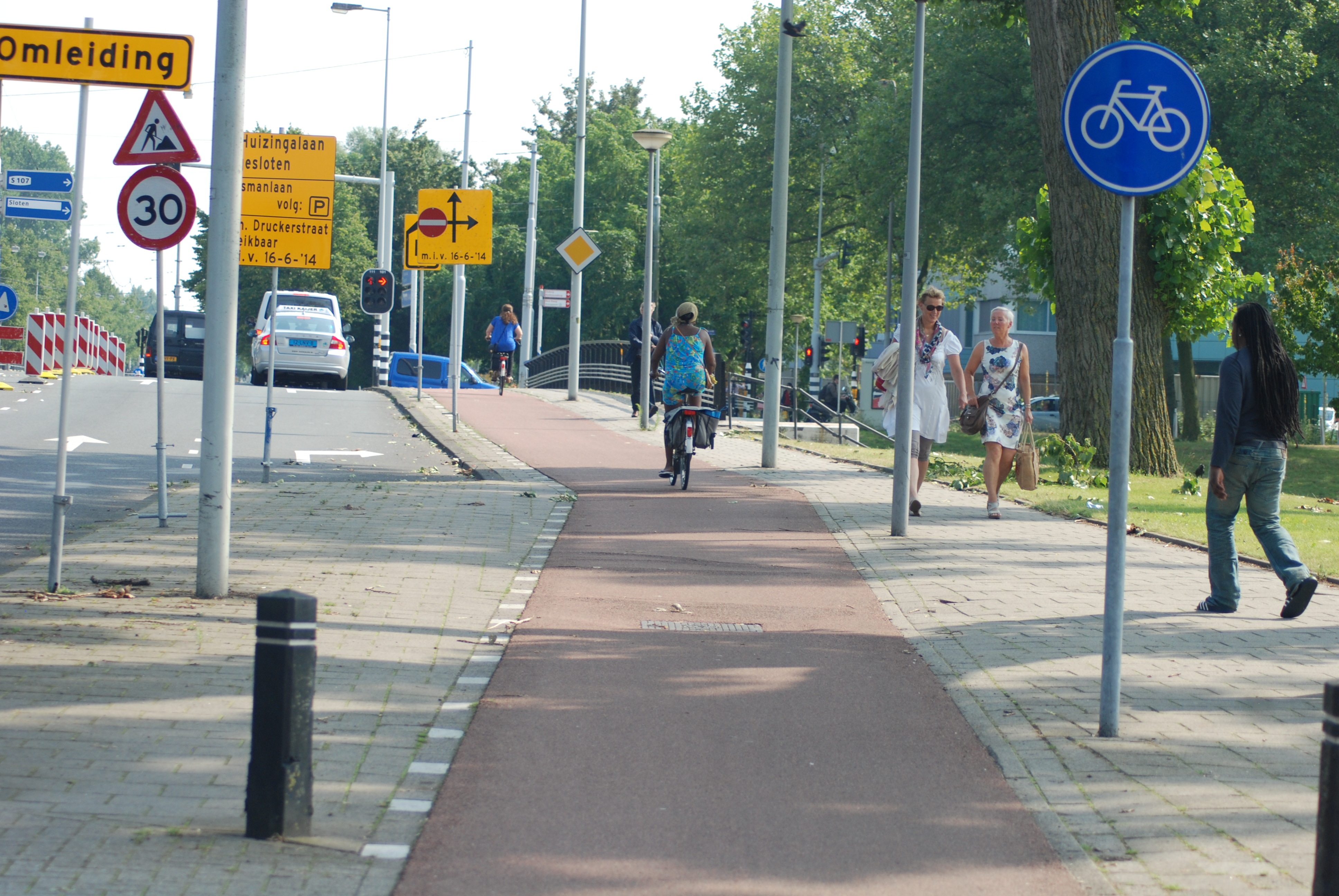
NYC has made great progress by adding more than 1,200 miles of bike lanes in all five boroughs, largely within the past 15 years. At the same time, just 480 out of 1,250 miles of these lanes are protected, meaning less than 40 percent of NYC’s bike lanes are physically separated from road traffic. Protected lanes ensure a much higher degree of safety by minimizing conflicts with other uses while signaling that cycling is a priority. Protected lanes also minimize - though certainly don’t eliminate - the need for enforcement. All too often, bike lanes are used for curbside passenger pick-ups or deliveries, forcing cyclists out into traffic. If designed effectively, protected lanes can keep vehicles out.
NYC’s bike lanes - where they do exist - are riddled with gaps. Most who have cycled in NYC can probably convey stories of cycling along a protected or conventional lane only to have it unceremoniously end into a throng of auto traffic. This is not only unnerving, it is extremely dangerous and is why gaps need to be addressed.

Not Built Fast Enough
The only way to get more protected bike lanes in NYC is by building them. But constructing safer, and more capital-intensive, protected bike lanes has proven to be slow, for a variety of reasons, ranging from community opposition at the block or Community Board level to slow construction schedules to unforeseen conflicts with adjacent infrastructure (power, water, transportation, etc). One particularly illustrative example is the one-mile stretch of Flushing Avenue in Brooklyn that connects Williamsburg to the Manhattan Bridge. A two-way protected bike lane was originally approved by the community board there in 2010, with a revised plan approved in 2013. Construction didn’t begin on the stretch until 2018 and was scheduled to be completed in a little less than a year. At the time of publication of this report, the updated completion date is set for Summer 2020. In other words, it will have taken 10 years from initial approval to complete this one-mile stretch.
If biking is to become a viable alternative, protected lanes will need to be built more quickly and efficiently. Even the Green Wave plan’s vision for constructing 30 miles of new lanes per year is low, compared with other aspirations.
Too Reliant on Paint
Green Wave also lacks a longer-term list of construction projects that would be game changers for cycling in New York. In the early 2000s, a number of relatively ambitious construction projects led the way for an accelerated expansion of bike lanes. They were the West Side bike path, restoring the bike and walk paths to the Manhattan Bridge and rebuilding the Williamsburg Bridge promenade. Those projects set the stage for the increase in bicycle lane painting and Citi Bike adoption between 2007 and continues today.
But these types of larger bicycle infrastructure projects are largely missing from NYC’s budget. While a few street construction projects are planned, plans to encourage cycling largely rely on painting more lanes, not building physical infrastructure.

The Streets Master Plan
In October 2019, the New York City Council passed a local law (Intro 1557) authored by Speaker Corey Johnson, which requires NYC DOT to create a Streets Master Plan every five years that sets a more bold agenda for redesigning NYC’s streets for pedestrians, cyclists, and mass transit. The law requires that the first edition, due in December 2021, identify 250 miles of protected bike lanes to install within the first five years, and the second edition in 2026 should, “include the completion of a connected bike lane network.” The law does not recommend Community Board approval for the lanes, a practice currently followed by NYC DOT.

The law represents a shift in approach to streets away from cars and toward the safety of pedestrians and cyclists, with a parallel aim of reducing congestion through new policies. Importantly, it takes more of a city-wide approach to constructing protected lanes, versus block-by-block or a Community Board at a time.
The Need for an Evolution
We know that demand for auto usage on our already congested and limited street space is on the rise at the same time that demand for biking is increasing. We also know that the only way to meet the demand for safe cycling is by adding bike lanes, with a strong preference for those that are protected. But the way we are building out a protected bike lane network is not working. Community opposition and expensive and lengthy construction processes result in fragmented - or worse, no - bike lanes. And with the political pressure to try and accommodate everything - trucks, buses, cars, bikes and more - on very limited space, it’s no surprise that we find ourselves in this current muddle of increasingly congested roads, inadequate curb space, and dangerous conditions for cycling.
We see hints of a better way in the Green Wave plan and even more in the Streets Master Plan, but even those don’t go far enough beyond the present approach.
If New York is to become a world-class biking city, it’s time to take a leap beyond the status quo. We need an evolution in how we manage and use city streets and we need to develop a network of priority, high-capacity, protected bike lanes that serve as the heart of a comprehensive and cohesive bicycle network.
To address the issues described above and make biking a more appealing, equitable, and accessible option, we propose a city-wide network of protected bike routes:
The Five Borough Bikeway
The Five Borough Bikeway would be a 425-mile network of protected, continuous, high-capacity, priority bike lanes that allows for timely, safe, and predictable bike travel for a variety of types of bike journeys. It would serve as the central spine of the complete network of protected lanes envisioned by NYC in its Green Wave plan.
Such a network of low-stress, continuous priority routes connecting all five boroughs would reduce intermodal conflicts, relieve roadway congestion and cut greenhouse gases, while accommodating new forms of mobility that transform the way New Yorkers move through the city.
The Five Borough Bikeway Network would also help to achieve many safety, quality of life, environmental, public health, and transportation goals already set by City and State leaders.
More than 100 miles of the bikeway already exist today in NYC’s established greenways and other protected bike lanes. Completing the remaining 300 miles is achievable and will require vision, leadership and a collective commitment to improve our city.

The Five Borough Bikeway would:
- Increase bike ridership by providing safe, predictable, and continuous routes
- Reduce intermodal conflict between bikes, cars, and pedestrians
- Reduce air pollution, including greenhouse gases, and shrink NYC’s carbon footprint
- Reduce traffic congestion due to cars
- Accommodate new modes of transportation and micro-mobility
What is an arterial bike network?
Due to the diversity of NYC’s street conditions, neighborhoods, and biking needs, there is no single design or definition for an arterial bike lane.
At a minimum, the routes of the Five Borough Bikeway must be safe, physically separated lanes that allow for a greater capacity of bike use and that connect to other local bike lane networks throughout NYC.


The Five Borough Bikeway may be in the form of two-way bike tracks, as currently exists along Prospect Park West in Brooklyn and Vernon Boulevard in Queens. Along busy, two-way arterial roads, the paths of the Bikeway may need to be on either side of the street. In other cases, the Bikeway could be routed along more residential streets in the form of “bike boulevards.”
Our vision for the Five Borough Bikeway is that it will be continuous, connected, conflict-free, and constructed.
Continuous
The Five Borough Bikeway must be free of the gaps that currently plague NYC’s current bike network. While the Bikeway cannot be built all at once, the process to construct it should focus on completing long, continuous stretches versus the fragmented, block-by-block approach followed today. Continuous, predictable routes allow bike riders, especially newer or less adventurous riders, to have more confidence in their journey. The Five Borough Bikeway’s routes must be developed in such a way to prevent bottlenecks, dismounting, unpredictable intersections, and other hindrances to smooth and rapid biking.

Orcutt/Bike NY
Connected
The Five Borough Bikeway must be centrally located and strategically connected to more local bike lane networks so that each New Yorker in every borough is within a reasonable distance of the lanes. Importantly, the Bikeway can serve as a community asset for every part of the five boroughs. The network would serve as a safe and inviting route for recreational riding for all ages and skill levels, a way to commute to work or school, run local errands, and even to serve as a first-mile/last-mile connection to transit. The Bikeway is not meant to supplant the construction of additional bike lanes and protected bike lanes across NYC, but to provide stronger links between those local routes

Jon Orcutt/Bike NY
Conflict-Free
The Five Borough Bikeway must ensure that conflicts - between bikes and vehicles or bikes and pedestrians - are at or near zero. Achieving this will require special treatment and signalling at intersections, a design that eliminates the opportunity for vehicles or pedestrians to enter the lanes, and enforcement that ensures those behind wheels, those on bikes, and those on foot are sticking to the rules.

Smaack, Roostock Germany
Constructed
The streets on which the paths of the Five Borough Bikeway run must be physically changed from their use today and must include physically separated lanes. How these lanes are constructed can range from fixed and raised bollards to the more capital intensive greenway lanes established in places such as the West Side of Manhattan and increasingly along the Brooklyn Waterfront.

Dave Reid

Case Study: Copenhagen
Copenhagen is often cited as the poster child for urban cycling worldwide. As of 2017, cyclists account for 28 percent of all trips in the city and 43 percent of trips to work or study. Copenhagen reflects the trend common in other cities, like NYC, that as ridership and bike infrastructure have increased, they have seen a decline in cyclist risk and injury. Part of this can be attributed to the theory of planning that every street should be amenable to cycling but that the treatment for each street should be based on its environmental characteristics. The proliferation of cycle tracks on many main streets in the city has produced a cycling environment where most cyclists can ride regularly as a safe, convenient alternative to cars.

Despite their success in centering cycling as a primary mode of transportation, Copenhagen is still looking to expand and improve their network by creating a superhighway for bikes called the “PLUSnet”. Copenhagen’s “Good, Better, Best” bike strategy for 2011-2025 looks to ensure, “a high level of quality for space, intersections and maintenance so that many cyclists can travel securely and comfortably at the tempo that suits each individual.” Part of NYC’s stated goal is to make it easier and faster for people from locations farther away from the city center to be able to access it via bike. NYC can look to Copenhagen as an example of a municipality connecting a large geography through a high-quality, safe, and well-maintained network of bike highways.
Design, Function, and Components of an Arterial Network
To create a safe, efficient and conflict-free bike network, the Five Borough Bikeway requires a baseline template for design that prioritizes separated bike tracks, reduced-stress intersection design, signal phasing, and clear connections to safe, local streets, while understanding that aspects of these component parts will be modular to fit specific neighborhood spatial constraints. Some of these elements are already incorporated into some of NYC’s existing network, but the proposal for the Bikeway is for all elements to be included along every route of the network.
Bikeway Requirement:
Separated Bike Tracks

New York City Department of Transportation
The Five Borough Bikeway prioritizes separated cycle tracks as the optimal bike infrastructure to reduce conflicts on the road. Different streets and contexts will require different configurations of this design. For most two-way streets designated with a bikeway, the optimal form of cycle track is one-way cycle tracks on each side of the street. These types of lanes utilize clear barriers, like elevated curbs or parking lanes, to provide a safe riding experience. A one-way protected cycle track not only reduces conflicts with cars by separating bicyclists from traffic, but makes the design and development of lanes within existing streets simpler than two-way cycle tracks by limiting variables at intersections. Our next preferred case, the Bikeway prioritizes one-way cycle tracks on parallel one-way streets where it is not possible to build on two-way streets. This form is best exemplified in NYC on 1st and 2nd Avenues in Manhattan where one-way protected bike lanes provide a safer riding experience.
The Five Borough Bikeway can utilize two-way bike lanes when routes are along edge conditions - streets with few traffic crossings, such as those alongside parks. Prospect Park West in Brooklyn highlights how planners can build along edge conditions to develop a safe, reduced-conflict two-way cycling path. Design guidelines suggest a best-practice width of 12 feet for a two-way cycle track with the minimum being eight feet in constrained locations. Additional space will be required for a buffer between the track and automobile traffic. This type of infrastructure while requiring a significant amount of dedicated space still provides areas of flexibility particularly around the width of the cycle track and the type of buffer utilized to ensure that the Bikeway can fit in any given neighborhood context.
Bikeway Requirement:
Safe Intersections

Greg Raisman, Portland Oregon
Experts emphasize that, “A network is only as good as its weakest link…In the street network, intersections are the most troublesome places.” An arterial network should employ proven design strategies to ensure that bikers experience low stress at intersections by ensuring that they are prioritized and visible.

Dutch Style Intersections
In Davis, California, planners have installed “Dutch Style” intersections which maintain a clear path for a cyclist through intersections and offer protection from turning cars.
“Bike boxes,” or delineated space in the right-hand car lane at intersections for bikes to remain visible while waiting for the streetlight to change, are used widely in cities with well-developed bicycle infrastructure. Whatever the specific design intervention is that works for the specific intersection, it is crucial for NYC DOT to ensure cyclist visibility, a clear path through the intersection, and space to stage while waiting.
Bikeway Requirement:
Signal Phasing

To help provide a smoother cycling journey, the Five Borough Bikeway should also utilize signal phasing, like the “Green Wave” used in Copenhagen that inspired NYC DOT’s recent plan. Signal phasing coordinates the timing of traffic lights to ensure a consistent ride for people traveling between 12-15 miles per hour. Planners can achieve this by shortening signal lengths, using slow progression speeds, and considering fixed time signals. A study of a 2.2 kilometer bike arterial in Copenhagen found that travel time was reduced by close to two and half minutes and average speed increased by more than five kilometers per hour after the Green Wave treatment. As NYC DOT has already described, the Bikeway will need to prioritize bike riders by applying a Green Wave treatment to these paths as a way to encourage more ridership.
Bikeway Requirement:
Local Connections

Lastly, as the Five Borough Bikeway develops, NYC DOT will need to connect neighborhood networks of on-street bike lanes to the Bikeway network in a way that provides stress-free connections to priority routes. A key principle to achieve a seamless connection to the arterial is emphasizing a clear, navigable hierarchy in neighborhood bike networks. Local streets with sharrows or painted lanes should easily connect to lanes with a buffer or more protection on higher speed streets, all of which connect riders to the arterial. To encourage these connections, NYC DOT should develop clear signage to direct people within neighborhood networks to the nearest Bikeway. We suggest, however, developing branding and signage specific to the Bikeway to make connections clear and easy.

Case Study: Amsterdam
Amsterdam is one of the leading cycling cities in the world, and offers useful design best practices that NYC could emulate and incorporate in a bike arterial network.
Amsterdam serves both as an excellent historical and present-day case study to see how a city shifted priorities in planning, street design, and resource allocation to create a system that now utilizes a high design standard.
Having pushed back against global trends for car-centric urban planning in the 1970s and 1980s through a grassroots organizing effort, Amsterdam followed the lead of other Dutch cities like The Hague and Delft by developing a more systematic network of cycle paths.
Close to 40 percent of all trips within Amsterdam are made on bicycle due to the extended effort by the local government to prioritize biking and create cycling infrastructure that is fast, safe, and easy to navigate.
On Amsterdam’s higher speed streets, the city employs separated, curb-elevated cycle tracks that provide a safe and legible path that connect to more local cycle paths. The cycle tracks utilize a distinct color and texture to provide a separation from both the sidewalk and the street. Intersections tend to offer clear, protected, and signaled paths for safely passing through or two-stage turning. These components as they intersect with low-stress local routes contribute to a unified, identifiable network that makes navigating the city by bicycle safe and easy for all bikers.
Benefits of the Five Borough Bikeway
Once constructed, the Bikeway will serve as a critical asset to NYC, providing a safe and reliable alternative to auto trips, and synchronous network to existing public transit. These benefits will result in better health, improved connectivity, cleaner air, and better access to jobs and other opportunities for all New Yorkers.
Increased Ridership by Providing Safety, Connectivity
The Bikeway creates an opportunity to greatly improve connectivity and attract a more diverse and broad section of New York to the benefits of cycling. A 2016 paper by the National Association of City Transportation Officials (NACTO) analyzed bike trends in various U.S. cities during the period of 2000 and 2013, and found that after the introduction of more cohesive, connected bike networks, ridership increased between 21 percent and 171 percent. To truly grow bike use, women, children, and all ages and races need to feel safe using the network.

The Five Borough Bikeway Can Help to Close the Gender Gap in Ridership
Despite the rapid increase in cycling in NYC over the past decade, a stark gender gap remains. A comprehensive arterial network must be able to not only alleviate the social stigmas that prevent women from riding, but also provide the necessary infrastructure to guarantee safety and connectivity.

While women comprise nearly half of the labor force, they make up only about 30 percent of bike commuters. The main reasons given by women for not engaging in the activity are safety concerns. In addition, some cite a lack of comprehensive infrastructure and disproportionate care-giving responsibilities. Riding implies a certain level of personal risk, and riding with children can be seen as endangering the life of another - a child. A successful network has to be both safe in fact and in perception.
The Five Borough Bikeway Can Help to Close the Racial and Ethnic Gap in Bike Infrastructure
Streets are far less safe for low-income neighborhoods and for people of color, due in part to a lack of investment in cycling infrastructure and a disproportionate implementation of safety programs, compared to other neighborhoods.

Less infrastructure and more unsafe conditions leads to increased policing and issuing of citations. NACTO notes a recent study that found that communities where most residents are Black or Latinx represented 12 of the 15 neighborhoods with the most citations. It’s no surprise then that a recent study found that fewer than 20 percent of Black and Latinx cyclists and non-cyclists feel comfortable in conventional bike lanes. Fear over personal safety or targeting by law enforcement are cited as the predominant reasons why. One survey found that Black and Latinx cyclists ride two times less frequently than do White cyclists. Such neighborhoods should be prioritized when implementing the Bikeway as they are the most susceptible to the negative outcomes of insufficient bike infrastructure.

Additionally, NACTO notes that long-term investments in safe and equitable bike infrastructure should be paired with an expansion of bike-share programs. NYC has already seen its own success with increased bike-share, considering the exponential growth of Citi Bike. What is interesting about Citi Bike’s success is that there have been various efforts to gain community support, particularly in marginalized neighborhoods. In 2018, in partnership with HealthFirst, Citi Bike expanded its existing NYCHA discount program to SNAP (Supplemental Nutrition Assistance Program) recipients, granting access to almost two million individuals to $5 memberships. However, various studies suggest that more can be done to incentivize ridership.
Addressing this historic underinvestment in infrastructure by building the Bikeway can serve as part of a larger and necessary effort by government to address institutional racism that daily diminishes opportunities for people of color.

Case Study: Seville
One example of how an arterial bike network dramatically increases bike ridership can be found in Seville, Spain. The capital city of Spain’s Andalusia region did not have a substantial amount of bike ridership prior to 2007. Until then, Seville only had about 12 km (~7.5 miles) of fragmented bike paths. Most of the bike paths were on active roads, which drove significant intermodal conflict and general refusal to partake in bicycling. However, after significant revenue influxes due to housing development and changes in local government, a protected and coherent bike network became a priority.
In 2007, Seville built 40 miles of protected bike lanes, an unprecedented increase. From 2008 to 2013, the system more than doubled when 46 additional miles were added, ensuring better connectivity across the network.

To supplement the new network, a bike-sharing system was also introduced, which allowed for 2,500 bicycles to be stationed at 250 docks throughout the city. The benefits of this network are seen in various aspects of transportation trends between 2007 and 2013. For example, after the completion of the first protected bike lanes, motor vehicle collisions with bikes decreased dramatically while the total number of bike trips surged from 13,000 to 72,000. The swift decision-making of Spain’s local government allowed for not only safer streets, but exponential growth in bike ridership. Seville’s bike network serves as a testament to the ability of a connected, extensive bike network to garner community support and make communities safer as a whole.
Reduced Conflicts with Cars and Trucks
Hostility to biking and additional bike infrastructure can often be traced to a fear of bikes and cyclists. Drivers fear that cyclists will behave irrationally and get in their way, while pedestrians fear bikes will not stop for them.
Conflict is indeed a serious safety concern. While the number of serious crashes involving cyclists per rider has declined, the overall number has continued to grow in NYC, notably spiking in 2019 with 29 cyclist deaths and 4,529 injuries. The number of pedestrians injured by cyclists was 267, much smaller when compared with over 10,000 pedestrians injured by motor vehicles.

Reduced GHGs and Other Pollutants
The 2019 Climate Leadership and Community Protection Act (CLCPA) mandates that New York State reduce its greenhouse gas emissions by 40 percent by 2030, and reach net zero emissions by 2050. This critical and ambitious emissions goal necessitates an “all hands on deck” approach, including reducing the number of auto trips. Cycle trips represent a clear opportunity to reduce the number of auto trips while also increasing system capacity. Currently 36 percent of emissions come from the transportation sector, the largest share of any sector. In NYC, private vehicles make up more than 90 percent of transportation sector emissions. Based on global studies, it is understood that biking infrastructure has the potential to contribute substantially to a decrease in greenhouse gas emissions. A 2015 report by ITDP estimates that a plausible “high shift” scenario in which bikes and e-bikes account for 10 percent of US trip miles could cut transportation-related carbon emissions by 11 percent. A 2016 study by McGill University found that for every seven percent increase in a bike network, there was a roughly two percent reduction in greenhouse gas emissions. While the study may not be entirely representative of urban cores like NYC, the overwhelming amount of research that shows an increase in the coverage and quality of a bike network leads to increased ridership further supports the likelihood of decreasing emissions in the transportation sector.
Public Health Benefits: In addition to climate benefits, reduced auto usage and related emissions will also improve the air quality and public health of city residents. It’s already well-established that there’s a strong link between air pollution and poor health - particularly heart and respiratory illnesses. We know that our communities of color and those of limited wealth suffer from greater levels of pollution and related illnesses. So it shouldn’t be surprising then that a recently published study from Harvard University has found that communities with more air pollution are suffering higher rates of illness and death from COVID-19. Expanding cycling opportunities city-wide will help to right the wrong of this environmental injustice.

Peter Burka
Reduced Congestion
The Five Borough Bikeway would provide rapid access to NYC’s central business district, whether from adjacent neighborhoods or the outer boroughs. It will serve as a vital network of infrastructure for commuters, exercisers, site-seers, and goods movement, helping to reduce the number of vehicles on streets.
Cargo Bikes: One area with particular promise is that of cargo bikes for deliveries. As described above, the retail landscape has shifted to more online shopping, and communities are seeing more deliveries than ever. NYC has begun to implement strategies for addressing the increase in standing delivery vehicles blocking bike lanes and even traffic lanes. One strategy being piloted currently is cargo bikes for local deliveries. Cargo bikes take up much less space than a delivery truck, but without a clear place for them on the street, other issues like slow speeds and erratic enforcement may arise that inhibit their future viability. The Five Borough Bikeway provides a clear place for them on the street, allowing for easy travel between neighborhoods.

City Harvest
Allow for Additional Micro-Mobility Modes
The Five Borough Bikeway is a critical part of the city’s transportation future. The Bikeway need not be only for traditional bicycles. It would also provide a safe route for other types of vehicles as well, depending on their size and speed. Growth in new and increasingly popular modes of transportation such as e-bikes, cargo bikes, and scooters has led to confusion over their place on streets.

These emerging transportation modes are promising ways to provide mobility while also reducing carbon emissions and congestion, but without the infrastructure to accommodate them, they risk causing more chaos on city streets.
Accommodating Emerging Modes of Transportation: As policies to address the growing popularity of e-bikes (including cargo bikes), pedal-assist and throttle bike technology evolve, in addition to kick-style scooters, the Five Borough Bikeway will serve as an important route for those using them, as it will efficiently connect the core to outlying networks. Along the Bikeway, the goal should be to ensure safety, enforce established speed limits, and prevent any device from blocking the paths, versus banning or targeting particular technologies. Accommodating these emerging modes of transportation makes the Bikeway that much more essential.

Charlie Benton
The map, developed in consultation with bike advocates from all five boroughs, should not be considered a plan, which will require community input and detailed engineering studies beyond the scope of this study. The routes shown here demonstrate the mix of scenic greenways, wide boulevards, car-choked commercial streets, and quieter back roads that can be adapted and transformed to create the continuous, core bike network that New York City needs.
Different treatments, designs, and allowances will have to be made to adapt the Bikeway to different streets. For example, routes depicted on one-way streets will often necessitate a parallel route in the opposite direction, not illustrated here. This map also does not include the local-level bike lanes that will be necessary to safely connect communities and feed into the city-wide Bikeway network.
Highlights from the Five Borough Bikeway:
- Connections to the Empire State Trail, including proposed Long Island extension -- from Van Cortlandt Park in the Bronx, to the Battery, to Kissena Park and the Queens Border
- Bike lanes on both the Verrazzano and Whitestone Bridges
- Access to LGA from Grand Central Parkway, and to JFK via the Air Train at Howard Beach and Jamaica Center
- New Greenways in Eastern Queens from Flushing Meadows Corona Park to Alley Pond Park, and western Staten Island along the West Shore Expressway
Implementing an arterial bikeway network in the nation’s largest and most dense city may not be easy, but it is necessary, timely, and long overdue. Getting there will require new ways of thinking, shaking up the status quo and, perhaps, reinventing some institutional relationships. But there are examples from across the nation and around the world to guide NYC in achieving this goal.
What will it take? First, we’ll need to improve the process by which we select routes to construct bike lanes. Then we’ll need to ensure that policies around our streetspace are helpful, not hindering to the process. Finally, none of this happens without the support from the community members who will benefit from this network.
From Vision to Capital
Transitioning from lines on a map to lanes on a street involves a complex process that spans multiple city agencies and earns the hard-won approval of local residents, community boards, and other relevant stakeholders. If NYC is going to rise to the challenge of quickly implementing the Five Borough Bikeway to become a world-class cycling city, the current process will need to be enhanced. The following recommendations aim to improve the process and shorten the timeline for completion of the Bikeway.
Set Ambitious Annual Targets and Hit Them
The Bikeway vision will need an influential champion that defies the political status quo, advocates for it, and sets the pace for its completion. The Streets Master Plan local law creates this opportunity for the Mayor by setting annual targets for implementation of protected bike lanes. Three hundred miles of the Bikeway will need to be constructed (60 miles/year for the next five years). The Mayor should seize this opportunity and ensure the Five Borough Bikeway is implemented as part of the Streets Master Plan. Each year, the Mayor’s State of the City report should present a summary of bike lane construction in the prior year and specific plans for construction in the coming year, including progress on the Bikeway. NYC DOT should be charged with tracking and communicating progress throughout the year, including transparency around any delays. This strong show of support for an arterial bikeway network will be critical to its completion.
Pick the Low-Hanging Fruit Immediately
Some segments of the Bikeway will be easier to implement than others, due to issues such as street width and use, community support, presence of existing bike infrastructure, budget and others. These low-resistance stretches -- provided they result in or help to form a continuous, protected link -- should be constructed first and celebrated as the first miles of NYC’s new arterial network. Additionally, gap-filling along existing, but fragmented, protected lane stretches could result in complete sections of the Bikeway network.

As described above, the vision for the Five Borough Bikeway is a fully constructed network of lanes, but if certain stretches can be developed with more short term, “quick-build” approaches (paint and bollards, parked car separation, etc.), those should be pursued in an effort to put the Bikeway on the map, but with a clear commitment and timeline for more complete construction.
Speed Up Construction
In NYC today, once plans for separated bike lanes are approved, construction of the project is carried out by the Department of Design and Construction (DDC). DDC was formed in 1996 to more efficiently manage the design and construction of most public buildings and infrastructure by consolidating the design and construction divisions of the Department of Environmental Protection (DEP) and NYC DOT into one department. While this consolidation has a number of important benefits, it can also create a backlog in project completion due to limits in capacity and a disconnect in priorities between the DDC and the agencies that oversaw planning of the projects. To date, multiple bike and street projects have faced years-long delays following community input resulting from delayed starts, unforseen conflicts with utility infrastructure, and the desire to keep lanes of traffic open during construction, among others.
In order to ensure the completion of the Bikeway, we recommend the formation of a new Task Force comprised of staff from the DDC, DOT, DEP, New York City Economic Development Corporation (NYC EDC), and other relevant agencies, the City Council Speaker and City Comptroller, as well as representatives from National Grid and ConEdison, and bike advocates to proactively and collaboratively identify current challenges and develop a set of principles for the rapid construction of the Bikeway and all other bike lanes required by the Streets Master Plan.
The Task Force will have a dual purpose to focus on both short and long term actions needed to implement the Bikeway. Initially, a smaller subset of the Task Force (at a minimum DOT, the City Council Speaker and Comptroller and advocates) should focus on immediate, quick-build opportunities to get the Bikeway fast-tracked on city streets as NYC opens up again. Then the longer term work of larger Task Force can begin.
The Task Force should analyze stretches of the Bikeway to identify alignment or conflicts with other capital projects and utility work to establish an ideal time horizon for construction of different segments, and where existing infrastructure might interfere with or slow construction. The Task Force can also determine full life cycle costs of different bike lane approaches, from paint to curb-separated lanes and everything in between. Finally, the Task Force should consider outside-of-the-box ideas around governance responsibility and authority, including whether NYC DOT -- potentially in partnership with other agencies including DEP and/or EDC -- might be better equipped to manage some or all of the bike lane design and capital work.
Set the Bikeway Up for Success
Ultimately, for the Five Borough Bikeway to be successful, it cannot exist in isolation, disconnected from the city around it. Bike infrastructure doesn’t stop at the lane, and any planning for an arterial network must also consider the supportive infrastructure that makes cycling work. It is recommended that as lane segments are planned that other infrastructure like bike parking, bike freight loading zones, and even user monitoring technology be considered as integral to the lanes.

Case Study: Paris
Over the past four years, Paris has added around 200 miles of new bike lanes to an existing network of 400 miles of lanes, and increased bike ridership by 54 percent between 2018 and 2019 alone. Mayor Anne Hidalgo has unabashedly promoted the efficient construction and proliferation of a better bike network via the “Plan Velo,” a $167 million plan which has succeeded in streamlining the planning, design, and construction of key protected bike facilities through Paris, aiming to make every street bike-friendly by 2024. Hidalgo has been successful by leading with a strong vision, setting ambitious but clear targets, and prioritizing high-impact routes like the left bank of the Seine River which could more easily become car-free. Remarkably, as Paris has begun to ease its COVID-19 lockdown, Mayor Hidalgo has committed to accelerate the timeline of Plan Velo to avoid the expected increase in auto traffic. To build on this work leading into the upcoming election for Paris Mayor, Hidalgo released a complimentary plan for future development that would create a “15-minute city” through the prioritization of protected cycling infrastructure that coordinates with land use planning to further promote cycling across a broader set of the population.

This case study shows that establishing a city-wide vision, prioritizing quality infrastructure over the quantity, and remaining steadfast against criticism from car users can help advance projects in the short term while building political support for further investments in the long term. It is important to note, though, that the French National Government provided both political and financial support to advance this transformation, which would be an unlikely condition within NYC.
Policy Changes: Reclaim the Right-of-Way
The public right-of-way is a stage with many actors. As a vision for the Five Borough Bikeway presents a meaningful way to safely and efficiently connect NYC, improve health, and reduce carbon and other air pollution, how we use the right-of-way will play a pivotal role. The policies and practices that govern the activities on our streets currently favor autos over bikes and pedestrians. Just one example is that existing bike lanes are frequently seen as an infringement on dedicated auto space. Bikes are not accommodated on every street even though cars are. This balance must begin to shift in order for the Bikeway to be successfully implemented. The following recommendations focus on changes needed in policies, practices and understanding of the right-of-way.
A Future with Fewer Autos

Street space is at a premium in this region. New York and other cities are particularly crowded, with pedestrians and cyclists competing for space with buses, cars, taxis, trucks, and emergency vehicles.

RPA’s Fourth Regional Plan suggests that in NYC alone, 80 percent of street space could someday be allocated to walking, cycling, and public transit, up from approximately 25 percent today.
Maintain and Enforce
Ultimately, the success of bike lanes requires that they remain operational for those using them. That means that the lanes must be in good working order and free of the conflicts that plague cycling in NYC today. NYC DOT has recently taken positive steps to improve maintenance by establishing an apprenticeship program of seven on-bike inspectors to evaluate bike lanes, respond to problems and inspect ongoing construction projects. This program should be evaluated and expanded to ensure coverage across the entire network as the Bikeway and other protected lanes are built.
To address enforcement, a dedicated bike-mounted unit focused solely on activities in and around bike lanes is required. This force would work to reduce conflicts, including illegally parked cars and delivery vehicles that block bike lanes, as well as cyclist and pedestrian infractions, to ensure that bike lanes operate smoothly and safely. The enforcement authority of NYC DOT should be expanded and a new enforcement unit of the agency should be created and funded to ensure that biking in NYC is safe and conflict-free.
Demystify the Right-of-Way
A legal and planning analysis should be completed for the street right-of-way, with particular focus on how streets can accommodate an arterial network of bike lanes. Such an effort is currently underway (as of Spring 2020) and will produce a report summarizing the analyses and visions for future use of the right-of-way.

Case Study: Oakland
Oakland is setting an excellent example within the United States of developing new biking infrastructure and channeling resources more equitably through data-driven analysis and deep community engagement. Over the past few years, Oakland’s Department of Transportation (OakDOT) has incorporated equity as a central value and metric throughout all its work, from resource prioritization to community engagement. Through this process, OakDOT identified the areas next to Lake Merritt (a heavily used central park location) as having both a high level of foot, bike, and car traffic, and problematic intersections. Taking in this information, they developed a separate cycle track to provide a long, safe route for cyclists while implementing traffic calming measures on the adjacent street and opening up additional space for public gathering. This intervention represents a straightforward implementation of a high-quality cycle track.

Oakland has also excelled in employing creative engagement and data-driven prioritization tactics to advance community-specific bike lanes. First, as a part of the creation of their strategic plan which centers on equity, OakDOT created nine criteria to determine resource allocation and weighted equity the highest. This framework prioritized historically under-resourced areas like Eastlake/Fruitvale over areas like North Oakland Hills that had been receiving a disproportionate amount of funding for street improvements. OakDOT then led a deep engagement process in partnership with previously overlooked community-based organizations like East Oakland Collective and the Scraper Bike Team to plan, design, and incorporate art into new bike lanes. The case study of Oakland emphasizes how prioritizing equity in data-driven analysis and community engagement can help mobilize untapped support for bike projects.
Building Community Support:
A Bikeway for the People, by the People
If NYC takes the bold and innovative step to build a bike arterial network for all five boroughs, it must be done in a way that harnesses the buy-in from the communities in which the Bikeway will be located. It must also be routed in ways that equitably share the benefits of cycling to all NYC neighborhoods.
Build Trust with Communities through Engagement
As NYC aims to dramatically expand bike lanes on city streets, engagement and trust-building with neighborhood residents in a productive manner will be essential.

Those discussions should begin with an understanding that the network will be implemented, but communities will be able to weigh in on specific elements of the route.
Community engagement is critical to the success of the Five Borough Bikeway. It can serve as an important starting point for conversations with communities about how to best expand opportunities for safe streets and cycling through linking into this new network of protected bike lanes.

Advance Biking Justice
The Five Borough Bikeway should be safe and accessible for people of all races and backgrounds. It offers a unique opportunity to ensure that residents in all five boroughs, including currently underserved neighborhoods, are better connected and have greater access to low-cost mobility, jobs, health, and recreation. The city-wide network should also link to NYC’s existing infrastructure in ways that promote equity, such as free passes between transit and Citi Bike. Underlying biking justice issues – as with all racial justice issues – is the need for government to address systematic racism and harassment on city streets. Until this larger context is ultimately addressed, improvements like the Bikeway will disproportionately benefit only certain segments of our greater population.
The ability to freely and safely cycle on NYC streets should be a right that all NYC residents have, regardless of age, gender, income, or race.


Next Steps
The Five Borough Bikeway builds upon decades of dedicated advocacy from bike and pedestrian leaders, transit riders, experts, and public officials who have envisioned a better future for biking and a more livable NYC. The strides we have made in recent years have set the stage for the Five Borough Bikeway, but if our elected officials do not move toward a unified vision to address our streets, NYC will continue to fall behind other world cities as a place that does not prioritize safe, sustainable, and accessible ways for people to move around.
It is time to get it done.
Acknowledgements
Authored by


This report was made possible through the thought leadership and generous support of Paul Gertner.
- Special thanks to the Bikeway Advisory Committee
- Paul Gertner of Harbor Ring, Jon Orcutt of Bike New York, Danny Harris and Marco Conner of Transportation Alternatives, Rachel Weinberger of RPA, Mike Lydon of Street Plans Collaborative, and Terri Carta of the Brooklyn Greenway Initiative
- Additional thanks to
- Moses Gates of RPA, Kate Fillin-Yeh of NACTO, Allan Friedman of 5 Boro Bike Club, Ira Haironson, Steve Scofield, Laura Shepard of Bike New York, and Rose Uscianowski of Transportation Alternatives
Related Reports
531