For nearly a century, Regional Plan Association has played an instrumental role in the planning and development of the New York metropolitan region. Since 1922, we’ve released three long-range regional plans, each which has tremendously shaped the tri-state area. These plans, unlike some of RPA’s other projects, are not meant to respond to current-day political realities. Instead, they look out beyond election cycles and chart a course for the region to get where it needs to be. These ideas are discussed, refined and advocated for across the span of years to bring proposals from plan to reality. And these proposals have transformed the way we commute to work, how and where we spend time in nature, and where and what we build.
With the release of the Fourth Regional Plan happening tomorrow, here’s a look back at how our previous plans have shaped the region we live in today.

The cover of the First Regional Plan.
THE FIRST PLAN: THE 1920s
At a time when the region was growing dramatically, there was was a lack of data and planning framework to shape this growth and provide the infrastructure and services needed for a larger, and more diverse population.
Newly incorporated, RPA produced the first basic regional map of New York and collected data to help define for the very first time vital characteristics about the region that could be used by RPA and others to plan. The first plan provided the blueprint for the transportation and open space networks we take for granted today.

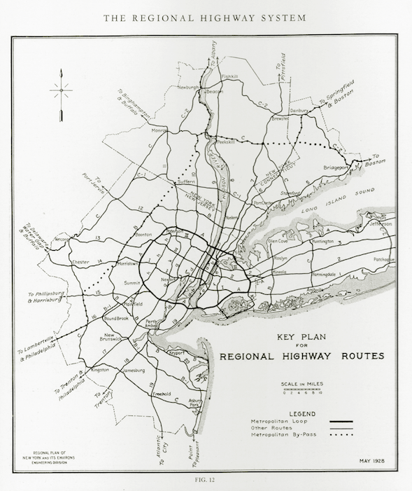
Regional Highway System, May 1928.
Highlights from the First Plan:
- Envisioned moving the George Washington Bridge from midtown (where it was planned) to 178th Street. RPA understood that the bridge would primarily be used for through travel and should therefore avoid the congestion of midtown.
- A high-quality interconnected highway network to facilitate regional mobility.. RPA’s first plan envisioned a more connected region with better surface transportation options. The New Jersey skyway from Elizabeth to the Holland Tunnel was completed in 1932; the Whitestone Bridge connecting the Long Island highway system with the Bronx arterial system was completed in 1939, and the Henry Hudson Parkway was built between 1935 and 1938.
- Preservation of parks and open space. Protection of the Palisades was a signature achievement of the first plan.

The cover of the Second Regional Plan.
THE SECOND PLAN: THE 1960s
In the 1960s the trend in the tri-state region and across the country was towards suburbanization and sprawl. Mostly wealthy, mostly white people were leaving cities in record numbers.The second regional plan identified and quantified the alarming trends caused by sprawl, including environmental degradation and decline of old urban centers. The second plan envisioned a regional network of economic centers connected by robust, and federally funded mass transit.

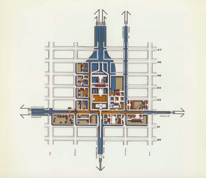
Grand Central Vertical and Horizontal Movements.
Highlights from the Second Plan
- The federal Mass Transit Act of 1964 adopted RPA’s principle of federal funding for the capital costs of urban mass transit.
- RPA called for Manhattan to become a commercial, financial and cultural capital on a national scale and for regional centers including in Jamaica, Queens; Downtown Brooklyn; Newark, NJ; and Stamford, CT to absorb most other growth.
- RPA recognized that the supply of undeveloped natural spaces was limited, and that without a plan to preserve natural landscapes, they would be used for development. The Second Plan called for the preservation of the region’s natural resources, building upon our landmark report, The Race For Open Space. Furthermore, it introduced the concept of national parkland near urban areas and led to RPA’s pivotal role in the creation of Gateway National Recreational Area, the nation’s first urban national park.

Cover of the Third Regional Plan.
THE THIRD PLAN: THE 1990s
In the early 1990s it was clear that the region’s role as one of the most vibrant and successful in the nation and the world, was not assured. The plan
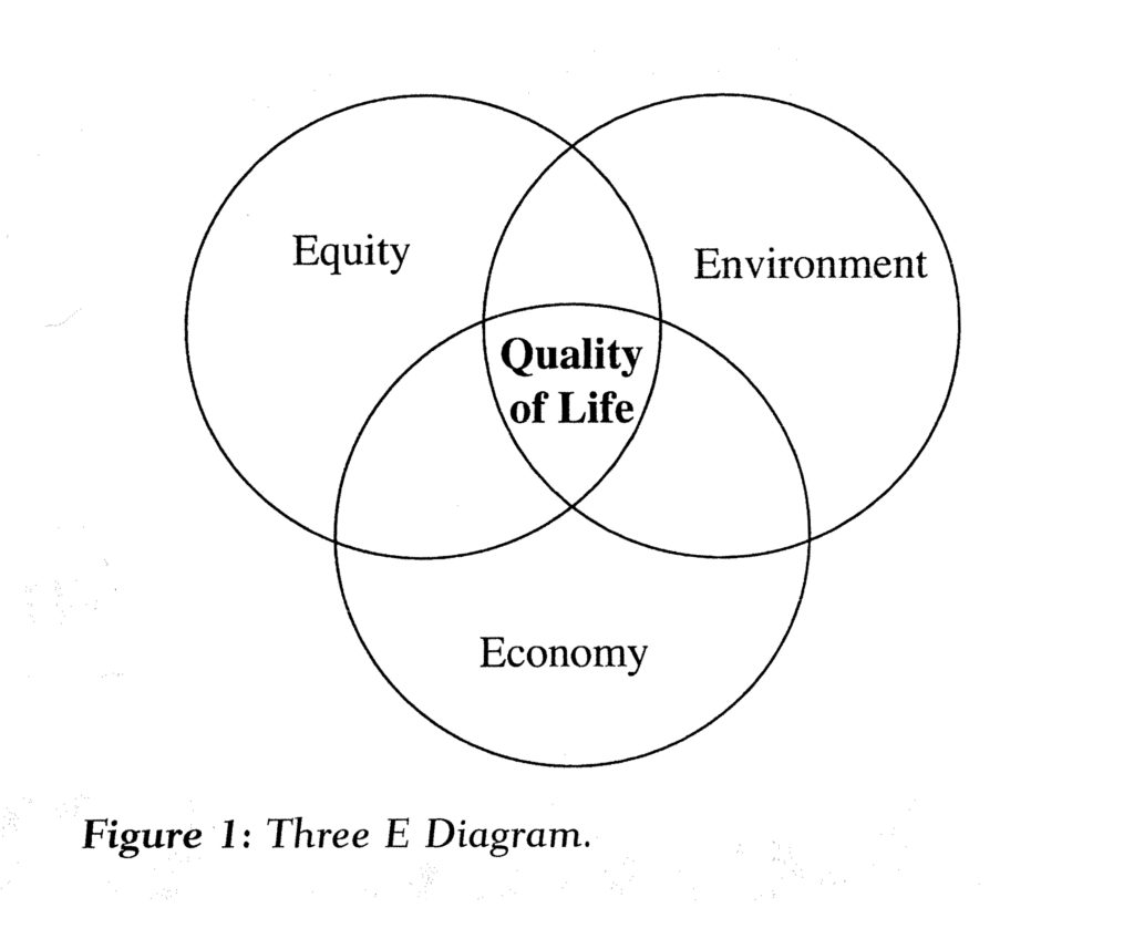
In its third plan, RPA suggested a holistic approach to growth, arguing that economy, environment and equity – what the plan called the “three E’s” – formed the basis of the region’s quality of life, prosperity and vitality, and that these had to be rebuilt, together. The plan proposed initiatives to boost economic activity in Manhattan, expand transit capacity throughout the region, to revitalize underutilized urban waterfronts of the New York-New Jersey Harbor and the Long Island Sound, as well as protect critical open space essential to protect the region’s other natural resources like drinking water.

The Third Regional Plan called for renewed economic development in New York City which was faltering. Major recommendations that are built or in progress include:
- A new business district for the Far West Side
- Second Avenue Subway
- East Side Access connecting LIRR to Grand Central
- The development of Governors Island and New Jersey Highlands
- RPA proposed eleven regional reserves, including the Central Pine Barren Commission that now protects 100,000 acres essential to Long Island’s groundwater supply
THE FOURTH REGIONAL PLAN: TODAY
The Fourth Regional Plan is a product of intentional research, deliberate dialogue with community members, experts and local leaders from across our region.
The result is a powerful call to action for the New York-New Jersey-Connecticut region to rise to meet the challenges of our time: a crisis of affordability, accelerating sea level rise and more frequent extreme storms, aging and crumbling transit infrastructure and institutions that too often fail to address these issues.

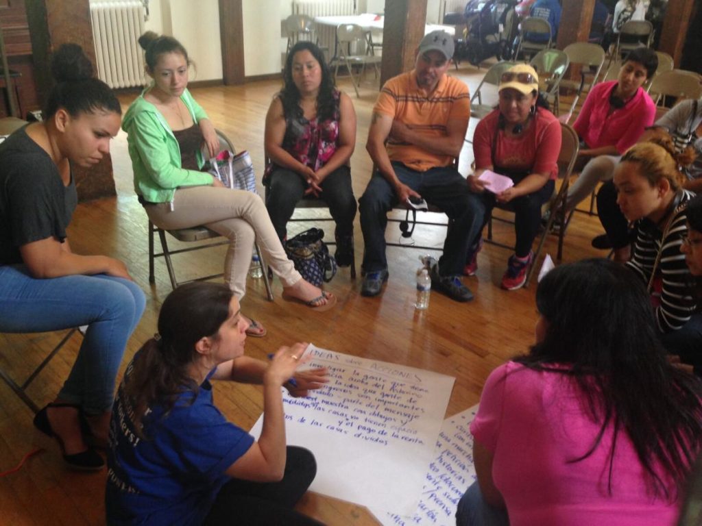
Over the past five years RPA staff analyzed gigabytes of data, held working sessions with over a thousand experts, hosted dozens of community meetings with thousands of local leaders, engaged with 9 community organizations representing 50,000 residents across the region, created hundreds of maps, charts, interactive features and released a dozen reports.
The process of creating the Fourth Plan put listening, collaboration and partnerships at the center more than any prior plan. More than solely relying on the strength of our analysis and research of the issues that currently plague our region, we wanted to make sure we heard the concerns of residents from across the region.
We look forward to working with the partners we engaged in the planning process to take this plan, like others before it from vision to reality.
