As our region prepares for and adjusts to sea level rise, flooding, and more frequent and intense storms, our existing network of coastal wetlands serve as natural storm-surge-reducing, flood-absorbing infrastructure vital to our communities’ sustained resilience. Coastal wetlands also play a critical role in supporting habitat diversity and healthy water quality.
But due largely to the draining and filling of wetlands for development over the past few centuries, our network of coastal wetlands today exist as a fragmented remnant of what they once were.
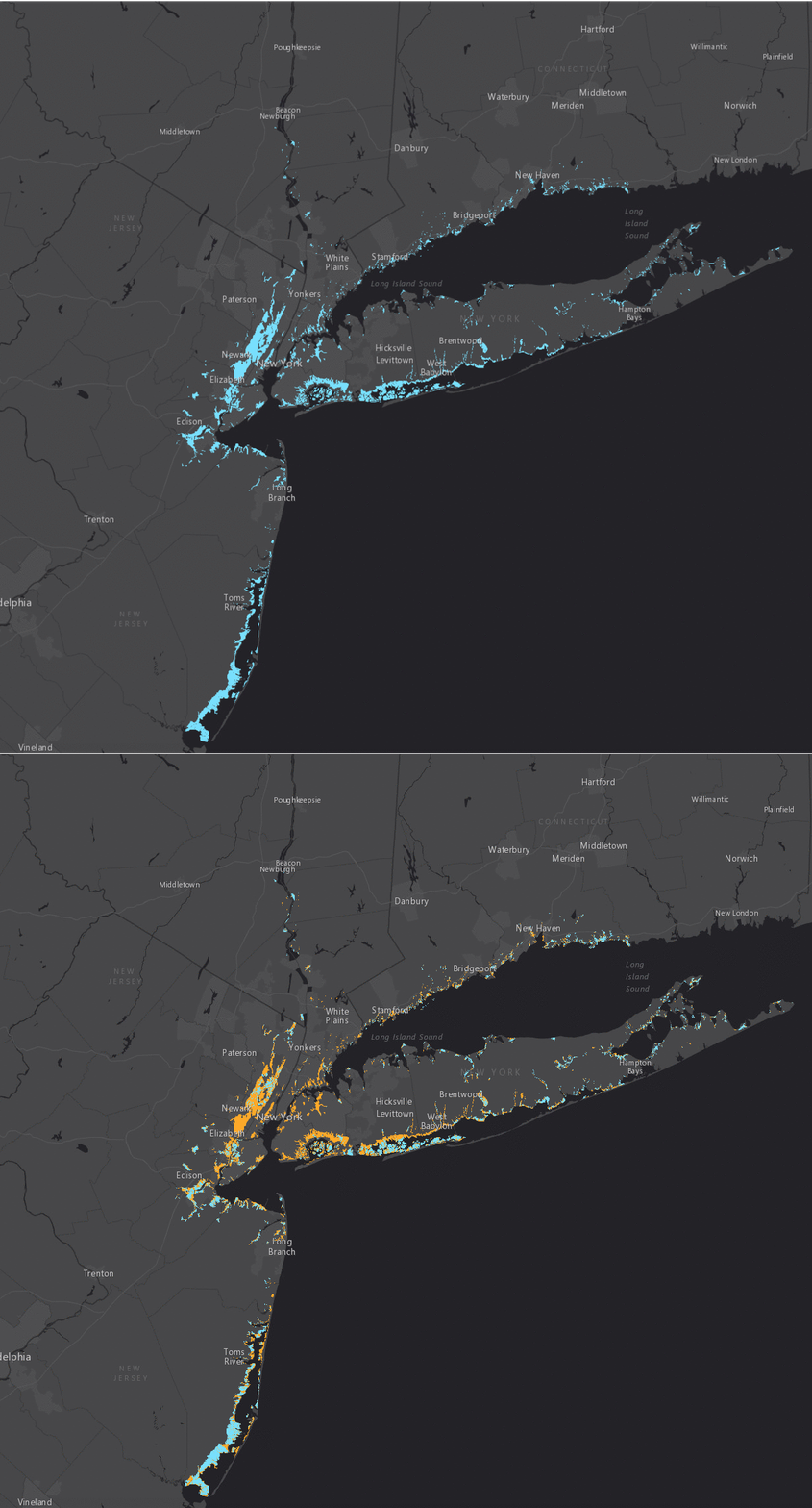
To identify the wetlands lost to development and dissolution and illustrate the extent of our region’s coastal wetlands as they once existed RPA created this interactive historic wetland map, traced from more than 150 mid-19th century National Oceanic and Atmospheric Administration (NOAA) Coastal Survey maps.
The blue on the map represents historic 19th century wetlands in the New York metropolitan region, while the orange designates those wetlands that no longer exist today. (Click here to view the full interactive map.)

Today, RPA estimates that nearly 900,000 regional residents live on what were once wetlands. Over two-thirds of the historic wetland layer overlaps with the FEMA Flood Zone map. While a little less than one-third (31.8%) of the original historic wetlands remain, the opportunity to invest in restoration and stitch back together this important network could result in increased resilience, greater biodiversity and improved water quality for our region.
A note about the layer: While we have reasonable confidence in the accuracy of the sizes and locations of this dataset’s unique features, we can’t imply that the dataset is comprehensive, for several reasons:
- Not every portion of the region’s coastline was included in the extent of NOAA’s survey.
- Not every plate from the NOAA survey was available to georeference.
- The level of detail between plates varied widely.
