
Sixteen Hudson Valley organizations working together to strengthen biodiversity and climate resilience while creating affordable places where people can live.
Room Enough for Both: Lessons from a Year of Planning for Housing and Conservation
May 19, 2026 webinar recording
Cluster Development: Housing that Fits our Towns
March 25, 2026 webinar recording. Click here to view slides.
Community Planning for a High Quality of Life.
December 3, 2025 webinar recording
Participants at November’s Newburgh Site Tour hosted by Alliance member organization Habitat for Humanity of Greater Newburgh


Watch the replay: Hudson Valley Alliance for Housing and Conservation
Healthy communities need both abundant, affordable housing and protected land that supports clean water, food production, climate resilience, and outdoor access.
Land is the common denominator - neither affordable housing nor conservation goals can be achieved without it. This unique, regional approach built on shared values, trust and mutual support is creating a new playbook.
Brought together in 2022 by project co-conveners Rebecca Gillman Crimmins and Steve Rosenberg, 14 of the region’s leading land trusts and affordable housing organizations are partnering to advance the effort.
The groups meet monthly, building relationships and trust and sharing information across our two sectors and with community members and local officials to strengthen ecological systems and climate resiliency while creating places where people can live sustainably within those systems.
We support communities that want to invest directly in addressing these needs; collaborate on model projects; and work with partners to help communities create road maps to achieve conservation and affordable housing goals in tandem – all to integrate the way we think, communicate about, and plan for affordable housing and conservation in our communities - together, instead of separately.
As an early demonstration of the two sectors’ commitment to working together, the groups:
- Developed a shared purpose statement that encapsulates the values and goals that bind them in this work.
- Created a list of shared public policy ideas for further exploration to de-silo existing programs and support both sectors; and
- Supported by RPA, created a GIS-based map of places that may be well-suited to collaborative projects.
Now, the Alliance’s work is beginning to show results. We’re creating new project models that address both needs, such as in Red Hook, where RUPCO, Scenic Hudson, Dutchess Land Conservancy and the town collaborated to conserve and ensure the affordability of 97 acres of farmland - which was transferred to organic Hearty Roots Farm - and to develop 40 affordable housing units on the remaining 12 acres.
We’re providing information and tools to support communities that want to address these needs, such as a webinar for which more than 200 community members and local officials registered.
Our work also has served as a resource for other aligned groups in the region, such as the Hudson Valley Farmer Housing Working Group, and has inspired a similar cross-sector collaboration in northwest Connecticut.
Looking ahead, to augment our capacity and extend our reach, we’re developing partnerships with experts at other regional organizations (Pace University Land Use Law Center, Hudson Valley Pattern for Progress, and the Hudson River Estuary Program) to support communities seeking to plan for housing and conservation in an integrated way.


The Alliance’s primary fiscal sponsor is Hudson Valley Pattern for Progress (Pattern), a regional organization that provides objective research, planning, and educational training throughout the region. Its work identifies civic challenges and promotes regional, equitable, and sustainable solutions to constantly improve the quality of life in Hudson Valley communities.
Pattern succeeds the Alliance’s initial fiscal sponsor Regional Plan Association, to which the Alliance is grateful for its role in launching the effort and its technical, planning, and administrative support.
The Alliance is grateful for support from The New York State Conservation Partnership Program (NYSCPP) and New York’s Environmental Protection Fund, administered by the Land Trust Alliance in coordination with the state Department of Environmental Conservation, which is being administered by Alliance member Columbia Land Conservancy (CLC).
Our Vision
The Hudson River Valley is a sustainable and inclusive home to an economically and racially diverse community. Our work helps the region develop a holistic, equitable and proactive approach to housing, climate change, and land conservation.
The Current Context
The Hudson River Valley region that we call home is becoming an increasingly unsustainable and inequitable place to live. A variety of factors have contributed to the present reality:single family sprawl over denser, smart growth development; the COVID-19 real estate boom; vulnerable existing rental housing, and the perception that affordable housing brings unwanted change to communities.
These factors have contributed to untenable real estate appreciation, the displacement of low-income and Black and Brown communities, and dwindling housing stock for families with modest incomes. Natural assets such as the Hudson River and its tributaries, hunting and fishing areas, and informal community open spaces are increasingly at risk due to unfettered real estate development. Climate change is threatening the environment. The loss of biodiversity, threats to sustainable agriculture and local food supply, urban heat islands, storms urges, and flooding are impacting our residents, infrastructure, and resources. These challenges affect us all.
Affordable housing and land conservation organizations have made progress addressing these issues within their own sectors. Yet, the problems we face are too urgent, massive, and intertwined to be solved alone. The current siloed approach is not accomplishing enough.
Our Work Together
We are banding together to take a holistic approach to these complex and urgent problems, and have a larger-scale impact.
Collectively, we can better serve Hudson Valley residents and communities by meeting the need for affordable housing, conserving important lands for human and ecological benefit, and adapting to and mitigating the effects of climate change. This collaborative approach allows us to leverage and learn from each sector’s successes, resources, methods, and constituencies. We hope that our collaboration will drive progress, serve as a model for change within and across sectors, and result in increased collaboration among our organizations and stakeholders. Our network makes us more nimble, equitable and expansive in serving our collective constituencies and realizing our vision.
We expect our work to include:
- Learning about each sector’s best practices and outcomes;
- Identifying shared interests and opportunities for collaboration;
- Leveraging our collective strength to pilot new approaches;
- Advocating for changes in public policy; and
- Communicating our shared priorities to our respective organizations, constituents, policy makers, and the public.
We hope that our collaboration will contribute to a thriving Hudson River Valley region that is more welcoming, inclusive, affordable, accessible, and sustaining to all who live here now and in the future.

Affordable Housing

Land Conservation

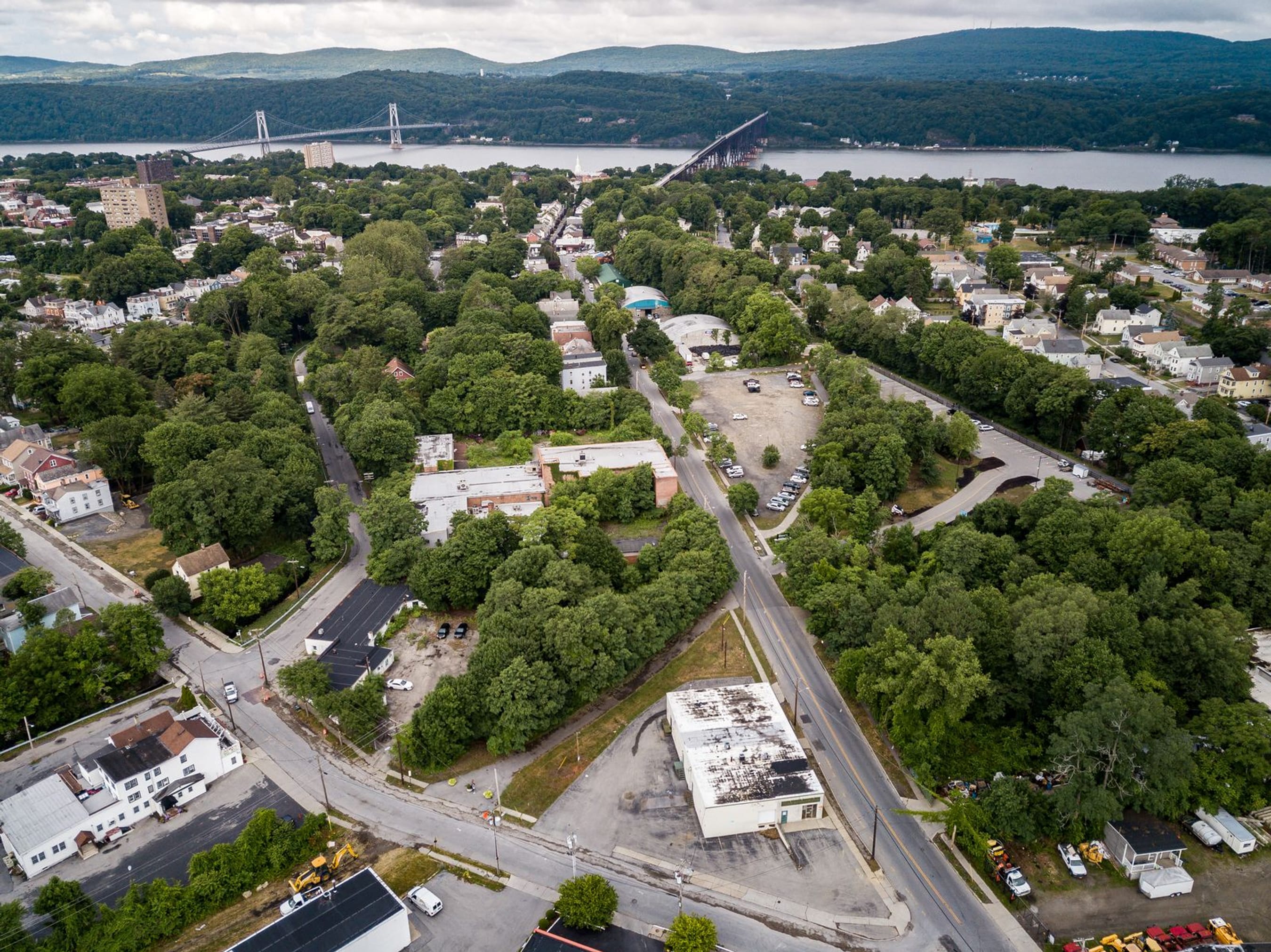
Poughkeepsie: Mid-Hudson Bridge and Walkway over the Hudson — image by Scenic Hudson Inc.
Regional Plan Association provided technical capacity to identify locations where the conditions appear to be conducive to on-the-ground collaboration. These are places where there is both suitability and perceived receptivity towards land conservation and affordable housing initiatives. The sites listed below reflect a quantitative analysis based on smart growth, land conservation and climate resiliency criteria, and a qualitative analysis of perceived political receptivity based on feedback from Alliance participants. Through this process RPA identified 32 potentially receptive localities, at least two per county within the study area. The locations include urban, suburban, and rural conditions.
Columbia County
- Ancram town
- Chatham town
- Chatham village
- Copake town
- Hudson city
- Kinderhook village
- New Lebanon town
- Philmont village
Dutchess County
- Amenia town
- Beacon city
- Dover town
- Millerton village
- Pine Plains town
- Poughkeepsie city
- Red Hook village
- Red Hook town
- Stanford town
- Washington town
Putnam County
Kent town
Philipstown town
Greene County
Athens village
Tannersville village
Ulster County
Kingston city
New Paltz town
New Paltz village
Orange County
Cornwall town
Cornwall-on-Hudson village
Middletown city
Newburgh city
Port Jervis city
Warwick town
Warwick village
Potential Places for Collaboration in the Hudson Valley
Places where conditions may be conducive to collaboration between affordable housing and conservation sectors.


Al Bellenchia, Executive Director/CEO, Columbia-Greene Habitat for Humanity. The group provides affordable homeownership for traditionally underserved communities. Al has global experience in strategic planning, marketing, management, and organizational development. Under his leadership, the group is evolving to provide more homes and services to low to moderate income families. He is a Trustee of The Friends of Lindenwald (home of President Martin Van Buren) and a director of the Kinderhook Tri-Village Rotary Club.
Adam Bosch, President and CEO of the Alliance’s fiscal sponsor Hudson Valley Pattern for Progress. Pattern provides objective research, planning, and educational training throughout the region. Its work identifies civic challenges and promotes regional, equitable, and sustainable solutions to constantly improve the quality of life in Hudson Valley communities.
Marissa Codey, Special Projects Advisor, Columbia Land Conservancy (fiscal sponsor for a grant from the NYS Conservation Partnership Program and an Alliance member). The Columbia Land Conservancy brings people together to conserve, appreciate and enjoy land. Marissa has 20+ years of experience working with individuals, families, community groups and partner organizations to facilitate conservation projects and transactions, many of which incorporate affordability provisions and techniques.
The Consensus Building Institute (CBI), a nationally and internationally recognized not-for-profit that provides organizational development and high-skilled facilitation for state and federal agencies, non-profits, and international development agencies. Ona Ferguson, senior mediator, has for 20 years designed and facilitated committees and big public meetings with a focus on helping groups work constructively together on natural resource and public policy issues. Abby Fullem, associate, supports the facilitation and mediation of environmental and public policy processes over the last 5 years including a suite of local climate projects.
Rebecca Gillman Crimmins, Alliance co-convener, has worked on the financing and development of affordable and supportive housing, as well as planning and policy in government and nonprofits for over 10 years. She is the Senior Vice President of Real Estate and Development at the Institute for Community Living. Previously, she was Assistant Vice President at New York State Homes and Community Renewal financing affordable housing across the State.
Javier Gomez, Director of Real Estate and Community Development at Alliance member Hudson River Housing, coordinates a broad range of real estate development activities, oversees community-based initiatives which promote neighborhood and community development access to housing services; and directs organization advocacy efforts at a local, state and federal level.
Seth McKee, Executive Director of Alliance member the Scenic Hudson Land Trust, where he oversees their land conservation, park creation and stewardship, and urban conservation work. Seth has 33 years of experience in all facets of conservation and real estate transactions and a proven track-record of leading diverse teams of professionals in pursuit of common goals. Seth is a member of the Advisory Council of the Land Trust Alliance’s New York program.
Steve Rosenberg, Alliance co-convener (dba Regionality LLC), is the former Sr. VP of Scenic Hudson and Exec. Director of the Scenic Hudson Land Trust. Steve served on the board of the Land Trust Alliance for nine years. He has led many efforts bringing land, equity and conservation together at the regional scale, including authoring the NYC/Hudson Valley Foodshed Conservation Plan, launching Scenic Hudson’s River Cities Program, and leading efforts to transform Hudson River post-industrial waterfronts into safe and inviting public places.
In this next phase, the participating organizations and project team are working together to:
- Communicate differently about their work, to implement the principles and values set forth in this process.
- Model collaborative projects, through regular, facilitated meetings of the ten participating groups and smaller working groups.
- Reach out to and expand the circle of organizations and interests involved in this emerging network.
- Share the work with state, county and local officials and agency staff.
- Develop policy proposals and legal structures to support cross-sector collaboration.
As the project advances, the groups will demonstrate through their work that communities are more sustainable when both needs are being met. Ultimately, the goal is to: bring about affordable, energy-efficient housing near existing town and city centers, accessible to conserved land; address the twin, rural challenges of housing families and workers and conserving farms and natural areas; adapt former industrial/commercial sites into housing, conserved land and renewable energy; and redevelop urban sites with affordable housing and access to parks, jobs, and local food. All of this will result in more equitable and climate-forward places to live.

Newburgh: Broadway view — image by Scenic Hudson Inc.
The Hudson Valley Affordable Housing & Conservation Strategy has been featured at several forums in and outside of the region:
- Regional Conservation Partnership Gathering, November 2024, Amherst, MA
- Land Trust Alliance RALLY 2024 National Land Trust Conference in Providence, RI, in September
- November 2022 Lincoln Institute of Land Policy Colloquium on Community Land Trusts and Conservation Land Trusts, case study presented by co-conveners Rebecca Gillman Crimmins and Steve Rosenberg
- February 2023 Connecticut Affordable Housing and Land Conservation Summit, Keynote presented by co-conveners Rebecca Gillman Crimmins and Steve Rosenberg
- March 2023 Massachusetts Land Coalition Annual Conference, Keynote presented by convener Steve Rosenberg
- May 2023 New York Land Trust Conference, Workshop presented by co-conveners Rebecca Gillman Crimmins and Steve Rosenberg, Habitat for Humanity of Columbia County executive director Al Bellenchia, and Scenic Hudson Land Trust executive director Seth McKee.
- May 2023 Annual Conference of New York State Affordable Housing Association, panel presentation by convener Rebecca Gillman Crimmins
- Steve Rosenberg spoke and moderated a panel discussion at the Salisbury Forum in September.
- Rebecca Gillman Crimmins and Steve Rosenberg keynoted the Mohonk Consultations Conference “Room Enough for Both” at Mohonk Mountain House in New Paltz in November.
Contributions of $10,000+
The project could not have proceeded to this point without generous support provided by:
- The JPB Foundation
- NoVo Foundation
- The New York State Conservation Partnership Program (NYSCPP) and New York’s Environmental Protection Fund, administered by the Land Trust Alliance in coordination with the state Department of Environmental Conservation.
- The Nature Conservancy
- Community Preservation Corporation
- Mission Title
- Dutchess Land Conservancy
- Scenic Hudson Land Trust
- And a number of other generous, anonymous donors
This section describes the methodology used to identify places where there is both suitability and receptivity towards additional land conservation and affordable housing initiatives. The suitability of a place was determined based on the quantitative analysis of physical attributes of both built and natural conditions. Receptivity was determined based on qualitative documentation of perceived local receptivity towards housing and conservation initiatives.
-
Quantitative Analysis
RPA developed a composite index to identify areas that could be suitable for collaboration between land conservation and affordable housing efforts. The index is based on a scoring system of the 32,000 census blocks within the six county study area, and is composed of metrics that suggest suitability for both smart growth and land conservation planning efforts. The index summarizes the physical conditions, both built and natural, of places within the study area. Additionally, with support from the Consensus Building Institute and based on the knowledge of HVAH&C partners, RPA facilitated a number of exercises and workshops aimed at documenting the perception of local and political receptivity of municipalities.
Composite index criteria:
Smart Growth Criteria
Land Use: Areas with existing residential density of 5 units per acre or more and places where primary uses are either multifamily or mixed use buildings.
Transportation: Areas close to transit infrastructure (1/2 mile to rail or ¼ mile to bus stop) and close to main roads (¼ mile to arterial or collector streets, highways not included).
Land Cover: Areas where majority of land cover is classified as urban or impervious (20% and 50% or more).
Sewers: Places where the majority of households are sewered (50% and 75% or more).
Land Conservation Criteria
Environmental Irreplaceability: Areas that have high irreplaceability value in terms of their capacity to advance biodiversity, climate resilience, and landscape connectivity goals.
Priority farmland: Priority farms for securing fresh and local food for New York City and the Hudson Valley.
Merging Criteria
After developing spatial indexes for each category, one for smart growth and another for land conservation, RPA staff combined them into a composite index. We added the totals of each index by assigning points from the land conservation criteria to blocks that met at least one of the smart growth factors. The result gives scores to geographies that are served by some degree of physical infrastructure and that are considered environmentally valuable.
Qualitative Analysis
With support from the Consensus Building Institute and based on the knowledge of HV AH&C partners, RPA facilitated a number of exercises and workshops aimed at documenting the perception of local and political receptivity of municipalities.
In Person Workshop
HV AH&C partners met in person to study over 30 large & medium scale map prints documenting the region. The maps were based on infrastructure, land use, housing, and environmental conditions. The main goal was to identify relevant indicators that could be used in site identification. The group also had valuable discussions about the limitations of the spatial data presented and lack of availability of relevant information (i.e. sewer infrastructure).
Virtual Workshops
RPA developed a series of online board exercises (jamboards) aimed at documenting local sensitivities and potential receptivity towards housing and land conservation initiatives based on the knowledge of HV AH&C partners. Participants were divided into two groups, one examining municipalities on the West side of the Hudson River, and another on the East side. Participants used icons and notes to describe existing opportunities or the lack of thereof. The boards provided insight into the level of political will or support and the reasons why certain locations may not be viable for collaboration.
Identification process based on quantitative and qualitative analysis
Map 1 Smart Growth Index: GIS based scoring system factoring land use, transportation, land cover, and sewers
Map 2 Land Conservation Index: GIS based scoring system factoring environmental irreplaceability and priority farmland
Map 3 Composite Index: Merger of smart growth and land conservation indexes
Map 4 Places for Collaboration: Composite GIS Index + Local receptivity based HV AH&C partners